Written in Stars: What Apache Celestial Knowledge Can Teach Modern Adventurers About Finding Their Way
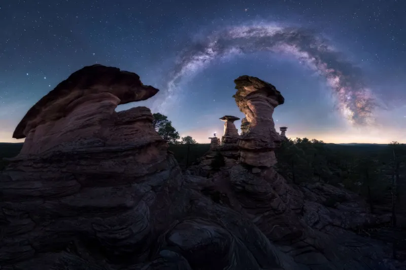
There's a moment that happens to almost every traveler who spends their first real night out in the Sonoran or Chihuahuan Desert. The sun drops fast, the temperature follows it down, and then the sky does something you genuinely weren't prepared for. It opens up. Not just a little — it opens like a door you didn't know existed. Thousands of stars, layered and dense, crowding the dark in ways that city life has trained you to forget are even possible.
Most people take a photo. A few sit with it for a while. And then, almost universally, they go to sleep without understanding a single thing they just looked at.
For Apache peoples, that sky was never background scenery. It was a map, a calendar, a clock, and a living library of knowledge passed down across generations. Understanding how Apache astronomers and navigators engaged with the night sky doesn't just make for fascinating history — it genuinely changes how you move through the Southwest wilderness, day or night.
The Sky as a Working Document
Apache communities across the Southwest — including the Western Apache, Chiricahua, Mescalero, and Jicarilla — developed sophisticated relationships with celestial patterns that served deeply practical purposes. This wasn't mysticism divorced from daily life. It was embedded in it.
Seasonal star patterns told hunters when game migrations were likely to shift. Specific constellation positions marked the timing for ceremonial gatherings, planting cycles, and long-distance travel. The rising and setting points of particular stars along the horizon functioned almost like compass bearings, helping scouts and travelers orient themselves across terrain that, to an untrained eye, can look deceptively featureless.
What's striking, when you start digging into this tradition, is how observational and empirical it all is. Apache star knowledge wasn't built on abstract theory. It was built on thousands of nights of watching, noting, and passing information forward through story and practice.
Constellations That Carried Meaning
While Apache celestial traditions vary across different bands and regions, a few recurring themes give modern travelers something concrete to connect with.
The Pleiades cluster — that tight, hazy grouping of stars in Taurus — held significant meaning for many Southwestern Indigenous peoples, including Apache communities. Its appearance in the eastern sky at dusk marked important seasonal transitions, particularly in autumn. When you're out in the desert in October or November and you spot that faint smudge rising low in the east just after sunset, you're seeing the same signal that generations of Apache travelers used to mark a turning point in the year.
Orion, visible through the winter months, served as a reliable southern reference point. Its belt — three stars in a nearly perfect line — rises almost exactly due east and sets almost exactly due west, making it one of the most dependable natural compasses available to anyone willing to learn it. Apache scouts moving through winter terrain could use Orion's belt to check their orientation without stopping, without instruments, without anything except eyes and memory.
The Big Dipper, part of Ursa Major, functions as a pointer to Polaris — the North Star — which sits almost perfectly above the Earth's north pole. Apache navigators understood that Polaris doesn't rise or set; it stays fixed while everything else rotates around it. Knowing this, a traveler in open desert can establish true north at any hour of the night, which means they can establish every other direction too.
Why This Matters for Modern Hikers
Here's the honest truth: most of us are terrible at navigating without our phones. Not because we're less capable than people who came before us, but because we've never had to build that skill. The consequence is that we're more anxious in the backcountry than we need to be, more dependent on technology that can fail, and significantly less connected to the environment we came out there to experience.
Learning basic stellar navigation — even just a handful of reliable stars and what they tell you — addresses all three of those problems at once.
Start with Polaris. Find the Big Dipper (it's almost always visible from the continental US on a clear night), trace a line through the two stars at the outer edge of its "cup," and extend that line about five times the distance between those two stars. You'll land on Polaris. That's north. The rest follows.
Then learn Orion's belt for east-west orientation, and practice spotting it until it becomes automatic. Add the Pleiades as a seasonal marker. That's honestly enough to start feeling genuinely oriented under a Southwest night sky, which is more than most travelers ever achieve.
The Practice of Sitting Still Long Enough to See
One thing that Apache celestial tradition points toward, indirectly but persistently, is the value of stillness and patience as prerequisites for real observation. You don't learn the sky by glancing at it. You learn it by sitting with it — repeatedly, across seasons, in different locations.
For travelers coming through the Southwest on a one-week itinerary, that kind of deep familiarity isn't realistic. But the habit of intentional looking is absolutely available, even on a short trip. Give yourself thirty minutes after full dark, away from any camp light. Let your eyes fully adjust — it takes longer than you think, usually fifteen to twenty minutes for real night vision to kick in. Then just look, slowly, and try to identify what you've already started learning.
The difference between a traveler who does this and one who doesn't is significant. The one who does it tends to feel calmer, more grounded, more genuinely present in the landscape. There's something about understanding even a little of what you're looking at that dissolves the vague anxiety of being somewhere unfamiliar and replaces it with something closer to belonging.
Bringing It Into Your Southwest Journey
If you're planning a trip through Apache or broader Southwestern Indigenous territories — and we'd love to help you do exactly that — building in dedicated night sky time is one of the highest-return investments you can make. The desert Southwest is home to some of the darkest skies in the continental US, particularly in southeastern Arizona, southern New Mexico, and the more remote stretches of West Texas.
Some of the guided experiences we offer at Apache Ta Tours incorporate evening programs that introduce travelers to the cultural significance of Southwest night skies alongside practical orientation skills. These aren't astronomy lectures — they're conversations, held outside, looking up, in places where the sky actually cooperates.
Bring a simple star chart or download a basic sky-identification app before your trip (SkySafari and Stellarium both work well offline). Use the app to learn before you go, then challenge yourself to navigate by what you've memorized once you're actually out there. The goal isn't to ditch the technology — it's to build enough knowledge that the technology becomes optional.
The Oldest Navigation System Still Running
The stars that Apache scouts used to cross the Sonoran Desert are the same stars overhead tonight. They haven't moved — not in any way that matters on a human timescale. The knowledge built around them is still accessible, still accurate, still useful.
There's something genuinely moving about that. When you learn to find Polaris, or to recognize the Pleiades on the eastern horizon in October, or to use Orion's belt as a westward bearing, you're not just picking up a survival skill. You're participating in a tradition of careful watching that stretches back further than any written record.
The Southwest sky is one of the great underutilized resources available to modern travelers. You don't need special equipment, a perfect memory, or weeks of study. You just need to look up — and know a little bit about what you're seeing when you do.